
Sea-Barrier
A sea-barrier in the Schlei
Not far from the Reesholm peninsula, the Schlei narrows to a few hundred metres. Not far from the Reesholm peninsula, the Schlei narrows to a few hundred metres. A crossing from the Schwansen to the Angeln peninsula would have been relatively easy. Ships also travelled through the Stexw iger Enge to Hedeby.
The 8th century saw a massive extension of the Danevirke – the North, Crooked and East Ramparts as well as the sea barrier of Reesholm were built as additions to the defence line, closing the gap in the defence system.
In 1925, when the shipping channel in the Große Breite was deepened, massive wooden structures were discovered. Subsequent archaeological investigations identified further structures of this imposing underwater system at various locations.
Further information at: www.kuladig.de
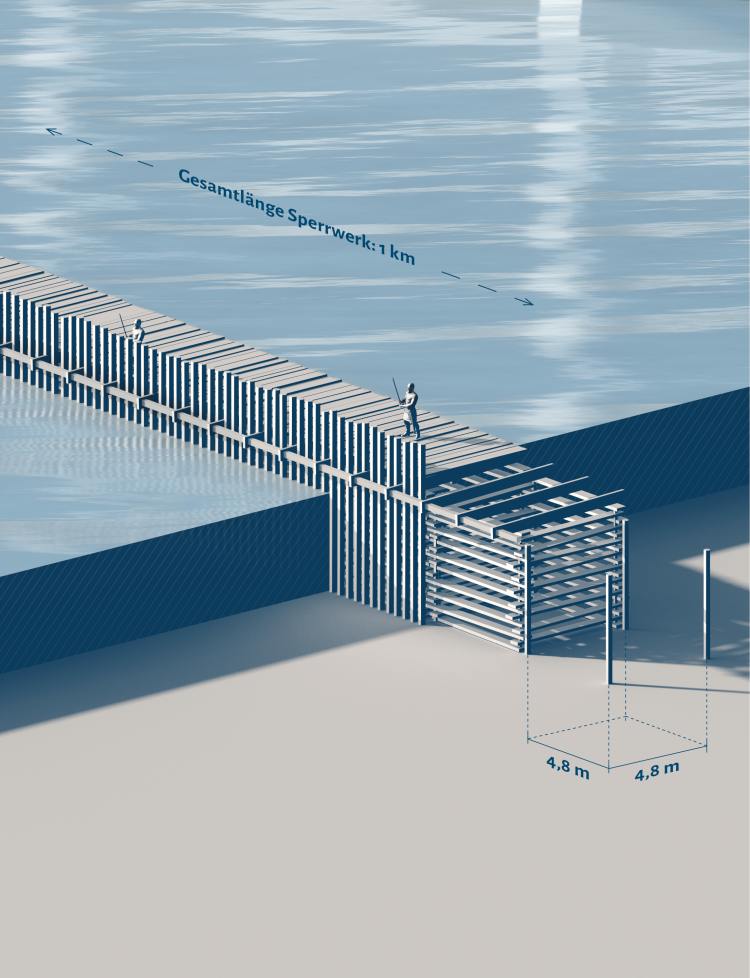
-

- Füsing an der Schlei